Camino Map: French Way Navigation App
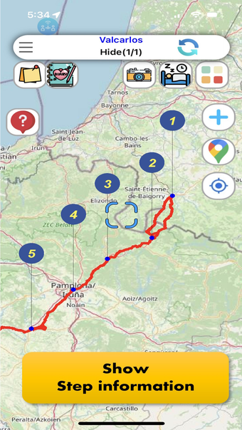
Camino Map for French way is an offline map application designed for pilgrims embarking on the Camino de Santiago journey. This user-friendly app offers detailed information on key locations like Albergue, Coffee Shops, and Restaurants, ensuring pilgrims are well-informed and connected. With its fast map rendering capabilities and high-resolution Camino trail display, users can navigate the route confidently without the need for a data connection.
The app integrates Google Maps for additional location insights and provides a comprehensive daily itinerary for the Camino Frances spanning 29 days. Users can personalize their experience by adding memos, place notes, and even writing private diaries. Multi-language support and features like group memos enhance the collaborative aspect of the pilgrimage experience.